
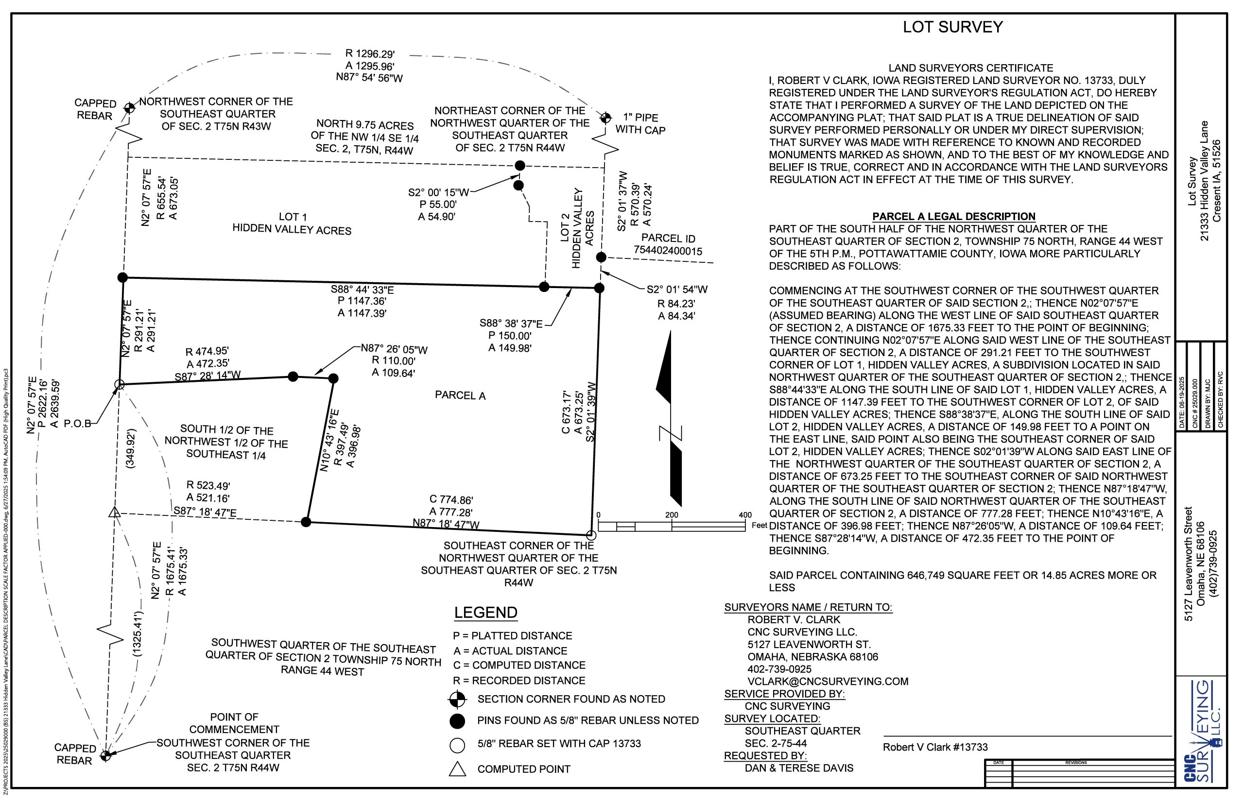
Boundary surveys have three important parts: a scale correct drawing, an unambiguous legal description, and iron markers set in the ground to memorialize property corner locations. A strong boundary survey agrees between field measurements shown on the survey, deed vs ground distances (and angles or bearings), and then “calls” to boundary markers shown in the drawing and mentioned in the recorded legal description.
Boundary Surveys – Why?
At CNC Surveying, LLC we perform boundary surveys for landowners who wish to professionally measure and record parcels of land, to fence their property, or to document their boundary lines with respect to an active encroachment. It is sometimes necessary to defend your property lines, and a recorded boundary survey will do just that.
Boundary Surveys are the core element of many other types of surveys. Boundary Surveys are included in ALTA surveys, right-of-way surveys, and platting of lots because of the transactional event. Boundary surveys are required to obtain building permits, to build a septic system, to properly write an ingress egress easement, or to dedicate or vacate a utility easement. Reasons that permits and easements need boundary surveys is accurate legal reporting for others reliant upon accurate property locations and area.
Construction of permanent structures is a situation where an accurate property location defines where a building or utility can be built (set-backs or adjacent development). Boundaries are mostly horizontal but there are situations where the height or elevation is required. Condominiums in multi-story buildings include floor number. Geological or mineral easements use depth. Airport glide paths, solar easements, and view easements restrict activity in a third dimension. Surveyors are needed to establish datums and reference lines and planes used to define these relative positions.
Boundary surveys have historical importance because monuments (evidence) are established, creating a precedent of location connected to time. People witness locations of fences, for example. Properties change ownership and create records which document the additions, subtractions, and changes of ownership. Titles and deeds are used to track this provenance for the owner, and for private and public parties who may share the boundaries or somehow be dependent upon their location now, in the past, or in the future.
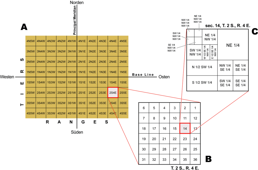
Boundary Surveys – A Rectangular System
In the United States we have (1) metes and bounds type of legal description and (2) the Public Land Survey system https://en.wikipedia.org/wiki/Public_Land_Survey_System . After the Land Ordinance of 1785 states west of the 13 original colonies (west of the Ohio River) land was surveyed and people began intentionally populating and farming the land. The Westward Expansion was facilitated by a rectangular system of aliquot parts of lands sold for $1.25 per acre to individuals, companies, institutions, or given to Revolutionary War soldiers, and then later granted to homestead couples for small fees. Individuals received a quarter-section or 160 acres. Married couples received 320 acres or one-half-section.